Methana Peninsula
Informations
Address:
J938+VC Methana, Greece
Methana Peninsula
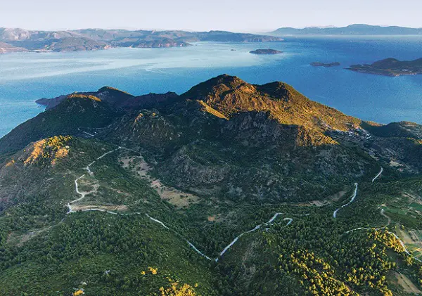
A designated Landscape of Special Natural Beauty and a protected area of 4994.46 hectares, a total perimeter of 36.1 km with a maximum altitude of 740 m. An impressive volcanic landscape, on the western slopes of Mount Cheloni, with wild reddish volcanic rocks that among them grow sparse trees, pines, arias, gorse trees, etc. Immediately above the village of Kameni Chora, there are picturesque terraces with traditional crops. In this village live a few inhabitants with a few goats, donkeys and chickens. From the volcano to the surrounding islands the view is amazing.
It is a jutting peninsula. Bare rocks in a large percentage of the surface with the characteristic brown color of the lava. Small clumps of pine and scattered isolated old pines. Extensive breadbasket. A relatively rare combination of the brown of the lava and the green of the pines with the dominant blue of the sea. The last known eruption of the volcano is mentioned by Pausanias and Strabo in 273 B.C. in the area of the main springs of the city of Methana although today Kameni is considered as the last crater (“active” according to the inhabitants) at the northwestern end of the peninsula.
The presence of 30 hot springs with a temperature ranging from 27 to 41 °C is also mentioned. Twenty-six of the springs are sulphuric aliphatic with hydrogen sulphide and carbon dioxide as the main components, two are chlorsodium with a high content of silicic acid, and two are acidic with various mineral salts. The springs are used to treat rheumatic, neuralgic, skin and stomach ailments.
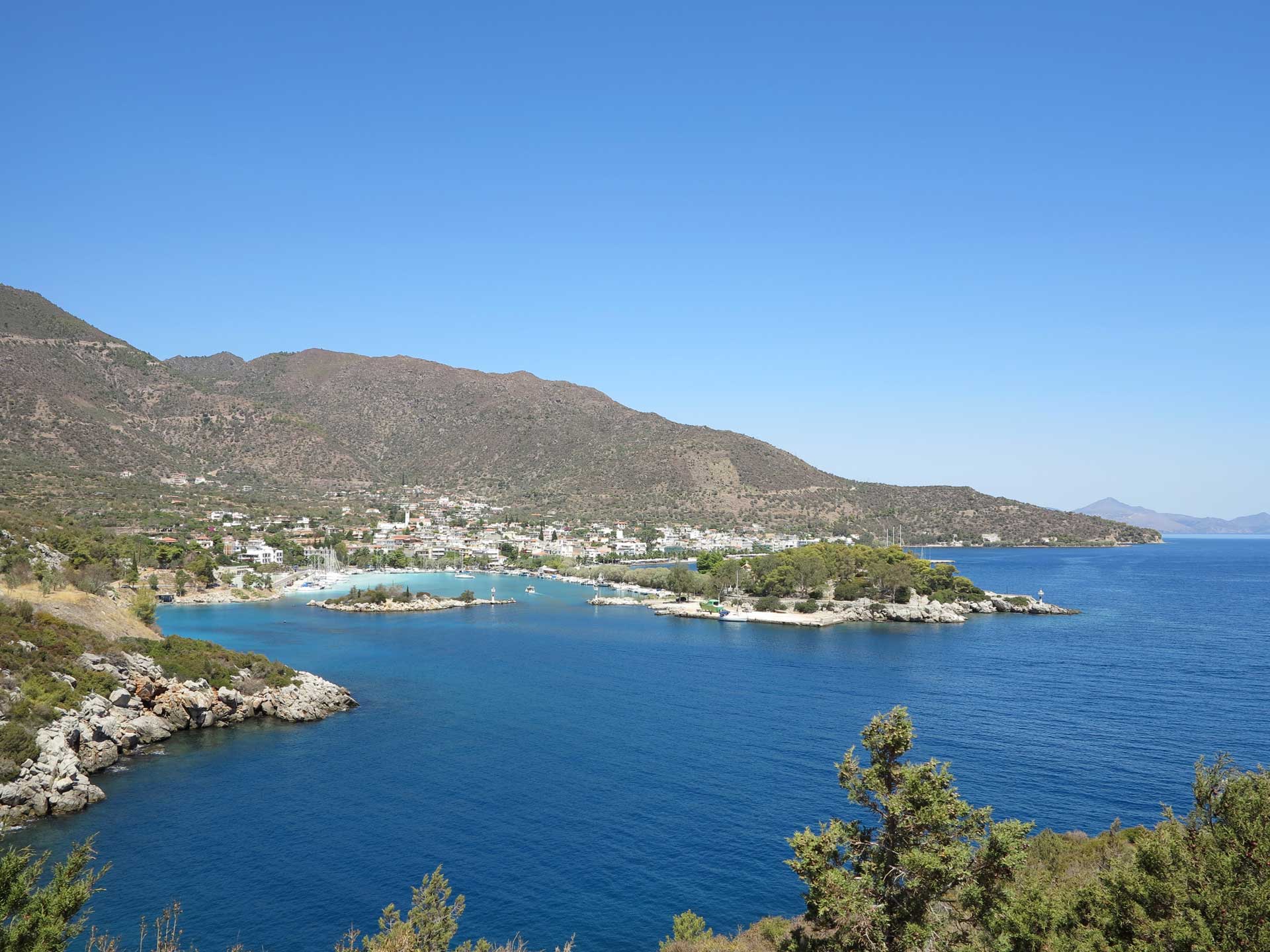
In the northeastern region, around the villages of Kounopitsa, Agioi Theodoroi, Kypseli, where the slopes of the land are gentler, vines, olives and almond trees are grown on terraces built with lava cobbles. The coasts are steep and rocky and in a few cases with lava cobbles. On the west coast there is a small picturesque bay sheltering small fishing boats. In general, the image of the volcano is awe-inspiring. Especially in the area of Kameni, one thinks that the lava will start moving again.