Useful
Information
Useful information
Mesogeia
Ag. Paraskevi, Pallini, Pikermi, Rafina, Artemis, Vravrona, Porto Rafti, Markopoulo, Koropi, Paiania, Ag. Paraskevi
A long route that requires the use of a private car. This road trip passes through eastern Attica and the historical region of Mesogeia. The coastal area is a favorite relaxation and recreation destination among Athenians, while the journey is filled with monuments, churches, archaeological sites, beaches, etc. The route is also suitable for people with disabilities, as long as they use a private car, although there might be some challenges concerning the facilities at some points (which are either problematic or non-existent).
The route includes the following landmarks, and their sequence indicates the direction of the journey.
Note: The orientation and safety of the walker/visitor is their sole responsibility. The present description, the related tracks (gpx) and the other informative material are simply a guide and do not in any way replace the personal responsibility of the visitor.
Main landmarks:
- Agia Paraskevi
- Stavros
- Byzantine Church of Agios Ioannis the Theologian in Pallini
- Pallini
- Pikermi
- The Roman Balneum of Rafina
- Rafina
- Alikes (coastal lake)
- Artemida Beach
- Sanctuary of Artemis Tauropolos
- Artemis
- Vravrona Beach
- Early Christian Basilica of Vravrona
- Archaeological Museum of Vravrona
- Ancient Vravrona
- Porto Rafti
- Agia Marina
- Olympic Equestrian Center
- Tower Phryctoria of Liada
- Markopoulou Mesogaias
- Koropi
- Paiania
- Vorres Museum
- Koutouki Cave
- Monastery of Agios Ioannis Kinigos (Philosophers’ Monastery)
- Agia Paraskevi
The tour starts from Agia Paraskevi square and continues through Mesogeion Avenue towards the Mesogeia region. These are the municipalities of East Attica that extend east of Mount Hymettus, which separates the Mesogeia from the plain of Attica. Mesogeia means the middle earth, and indeed, this large part of Attica is situated in-between of two seas, creating a unique peninsula scattered with vineyards, fig orchards, pistachio plantations, and pine forests, forming an important map of agrotourism, wine tourism, cultural tourism, and generally an attractive landscape next to the capital.
The journey begins in Mesogeia, the cluster of East Attica municipalities that extends east of Mount Hymettus, separating Mesogeia from the Attica plain.
The first stop is the ruins of the Byzantine Church of Agios Ioannis the Theologian in Gerakas. Dating back to the 12th-13th century, it belongs to the architectural type of the compact cross-in-square with a dome. The octagonal dome of the church was preserved until the early 20th century, but today only the two western spherical triangles remain. The church was constructed with rough stones, bricks, and mortar, while the dome was possibly made of limestones. Ancient structures, possibly from the significant ancient Temple of Athena Pallenis, are incorporated into its masonry. It is one of the few Byzantine churches in Attica that has been preserved without significant later additions. Inside, frescoes dating back to the early 13th century are still preserved. Next to it, there is a newly built temple.
Hitting the road to Rafina, between the intersection and the port of Rafina, you will encounter the Roman balneum (bathhouse). Baths were a fundamental element of the culture of the time, not only for body cleanliness but also as places for social interaction. However, they were also costly projects, requiring water and a lot of fuel for heating the floors and walls. In its initial phase in the 2nd century AD, the Roman Balneum In Rafina was quite large – its boundaries are still unknown. From the 3rd century onwards, it is limited in size but quite luxurious, as indicated by the mosaic remains and marble decorations unearthed by excavations. Next to the monument, the surface of an olive oil press basin made of limestone has been revealed, with a diameter of 1.68 m. The basin is a common vessel in the procedure of processing the olive fruit from classical to modern times. In 2014, a unique finding came to light – an inscription engraved on the oil press basin that reads: “Kl(audia) Nikagora / M(arkou) Iun(iou) Mna/seou gunē / eisēgan / Aur(elius) Aristonēikos epoiei / archonti Dionysiō.”All mentioned in the inscription, including the artisan of the basin, bear Roman names.
We proceed to Rafina, the port of Mesogeia, on the coast of East Attica. The area, due to its location and beauty, has been inhabited since prehistoric times. In 3200 BCE, the settlement of Asketario was built, south of the current location of Marikes Beach. The revival of the area in recent years occurred during the Asia Minor catastrophe of 1922. Many residents of Triglia in Asia Minor came to Rafina, most with the ships of Triglian shipowner Philippos Kavounidis. They settled in Rafina and formed a refugee settlement named “Nea Triglia”, which, however, did not prevail over the ancient toponym. Rafina was the ancient Municipality of Araphenon. Today, Rafina is the second-largest port in Attica after Piraeus and one of the largest in the country. In recent years, it has experienced significant growth as more and more coastal lines with state-of-the-art modern ships choose its port for routes to Euboea, the Cyclades (Andros, Tinos, Mykonos, Paros, Naxos), and Crete. It is a densely populated area in the center near the port, but it has large areas with parks and green spaces, as well as two large beaches—the first one next to the port and the second, the popular Marikes Beach, at the Avlaki area. Around the wider area of the port, you will find restaurants and ouzeri, renowned for their quality, variety and affordable prices, as well as cafes and clubs for nightlife entertainment.
As you continue towards the vast sandy beach of Agios Nikolaos, mainly known as Loutsa Beach. Behind the southern part of the beach, you will encounter a shallow lake with sweet water, covering an area of 216 acres, connected to the sea by a small stream that fluctuates depending on the seasons. It is known as the Wetland of Artemida or the Marsh of Loutsa or the Salt Lake of Loutsa. The area serves as a significant wetland in Attica. Its vegetation includes dense reeds and many tamarisks around the water. Due to the connection of the Marsh to the sea, various fish species find shelter here for reproduction. The abundance of fishes attracts many bird species in search of food. Over 100 species of permanent and migratory birds have been observed in the Marsh.
On Loutsa or Artemida beach, right next to the sea, you will also come across the Sanctuary of Artemis Tauropolos. Only the foundation of the temple remains, made of limestone, which was a Doric peripteral temple dating back to the late 5th century BCE. The structure is divided into a large eastern section and a smaller western one, interpreted as the adyton. In Euripides’ “Iphigenia in Tauris”, Orestes is mentioned as the founder of the sanctuary, transferring the goddess’s cult image from Tauris and landing in Aulis, on the eastern coast of Attica, to build the temple. To honor the goddess, the “Tauropolia” were held, including nocturnal processions, wild Dionysian rituals, and symbolic acts of human sacrifice.
Approximately 200 meters south of the Sanctuary of Artemis Tauropolos, a small temple with a deposit was revealed, containing numerous dedications dating from the Geometric to the Classical period. The findings from the Sanctuary of Artemis Tauropolos and the small temple are displayed and preserved at the Archaeological Museum of Vravrona, which you can visit later.
The Archaeological Museum of Vravrona is situated between Rafina and Porto Rafti, just 200m from the archaeological site of the Sanctuary of Artemis in Vravrona. It is one of the most important ancient sanctuaries in Attica, where visitors have the opportunity to combine a visit to the outdoor site with that of the museum’s indoor space. The museum showcases the history of Vravrona, the monuments of the sanctuary of Artemis, the traditions related to the sanctuary’s foundation, the worship and attributes of the goddess, and the history of Mesogeia. The exhibits include various vessels, small and larger dedications, statues and statuettes, children’s heads, and votive plaques. The museum is small but has interesting exhibits for children, such as ancient toys and statuettes of small children (known as “arkti “, which are bear-shaped statues).
The archaeological site of the Sanctuary of Artemis in Vravrona is hidden amidst hills deep within the Attica countryside. From the mid-5th century BCE and throughout the 4th century BCE, it was at its peak. According to the myth, Orestes and Iphigenia brought the worship of Artemis to Attica from the land of the Taurians. In “Iphigenia in Tauris”, Euripides explains that Orestes, in order to be redeemed from the Furies tormenting him for the murder of his mother (following Apollo’s oracle), traveled to the Taurian land where his sister Iphigenia lived. He stole Artemis’s statue, and together with his sister, transported it to Vravrona. In Vravrona, following the goddess Athena’s command, the siblings established the temple, and Iphigenia served as its priestess until her death. The mythical tomb of Iphigenia is also present at the archaeological site.
The archaeological site today is well-maintained and visitor-friendly, with benches where one can rest. Detailed informational signs familiarize the visitors with its history. The tour follows a specially designed path leading around the Stoa with its magnificent Doric columns (late 5th century BCE) and other points of interest. Among these are the gushing Sacred Spring, the center of ritual acts such as “sacred purifications”, and the stone bridge, which likely marked the end of a sacred road from Athens to Vravrona.
Next to the archaeological site are the wetlands of Vravrona, one of the most important wildlife sanctuaries in Attica and a Natura 2000 area. The Hellenic Ornithological Society, with the support of the Athens International Airport, is responsible for its protection and promotion. Here, there is a beautiful circular walking trail with signs placed at various points, providing information about the fauna and flora of the area. In spring, the wetland is filled with migratory birds that can be observed. If you are lucky, you will see, among others, all species of herons, as well as others such as the bittern and the coot. It’s a good idea to take binoculars with you!
To the west of the temple of Vravrona Artemis, just a few meters away, there is a three-aisled basilica. The temple was built after the mid-5th century BC and was destroyed around the 10th century. It constitutes an imposing place of worship that aspired to overshadow the glory of the neighboring pagan temple of Artemis. The aisles are separated by two colonnades, consisting of seven fluted columns made of Pentelic marble. Featuring Ionic column capitals, possibly taken from some Hellenistic building. The sanctuary is semi-circular, and its floor is paved with colored marble. In the center, the four bases of the Holy Table are preserved. The main temple has pedestals on the long sides in order for the congregation to be able to sit, and it is separated from the sanctuary by upright marble slabs with embossed decoration, known as thorakia – a type of parapet. In the early 18th century, a single-room chapel with an apse was built inside the central aisle of the basilica, following the design of a single-aisle basilica. Only its foundation survives today. Therefore, the name of the saint to whom the two temples were dedicated remains unknown to this day.
Moving on to Markopoulo, you will be able to visit the Olympic Equestrian Center, especially if you are a horse enthusiast. The Olympic Equestrian Center was constructed in Markopoulo, in the area of Merenta, so as to host the Olympic Summer Games of 2004. It was completed in October 2003. The infrastructures are one of the most contemporary in the world. The Olympic Equestrian Center hosted the sports of Dressage, Show Jumping, Equestrian Triathlon, and Para-Equestrian during the Olympic Games. The Center covers an area of 940,000 square meters and includes workspaces, permanent stands, competition areas, stables, and parking spaces.
In Markopoulo area, relatively close to the Equestrian Center, on a hill known as Liadas, stands a tower from the Frankish period. The tower is located on the eastern edge of the hill, east of the Byzantine temple of Taxiarchis Dagla. It is in quite good condition, albeit without its battlements, which were used as construction material in the previous century. The tower belonged to a broader network of watchtowers and fortifications, a practice introduced by the Frankish conquerors to control significant passages and counter dangers from pirate raids. This network included other towers in the Mesogeia region and Attica in general. Today, most of these towers in the Mesogeia region have been destroyed, except for the tower of Vravrona or Vraona, which can also be visited. The Burgundian De la Roche family built both towers.
Each tower-vigla was in visual contact with the previous and next tower. In this way, the message was transmitted from tower to tower very quickly. The fire that created the smoke for the day and the flames for the night was lit by the Watchman on the tower’s roof. It is said that it only took an hour for the message to reach from the coast of Asia to the coast of Europe. In general, the towers were constructed in the same way, square and usually three-story, always built of stone and with intermediate elements of ceramic materials.
As you head towards Paiania you should visit the Vorre Museum, a timeless museum of folk and modern art. It is a donation from Ion Vorres, in the form of a cultural non-profit foundation. The museum receives an average of 10,000-15,000 visitors a year, Greeks and foreigners, as well as a large number of students. It is located on an area of 14 acres, scattered with buildings, gardens and courtyards. It consists of two sections, the folklore section “Pyrgi”, which was the residence of Ion Vorres, and the museum of modern Greek art. The museum’s facilities include over 6,000 exhibits, covering a large period of Greek history and art. It also includes two houses from the Ottoman period, along with a stable and a press.
A little above the Vorre Museum, on the eastern slopes of Mount Hymettus at an altitude of 510 meters, lies the renowned Koutouki Cave. The cave is open to visitors and is one of the most beautiful in Attica, featuring rich lithic decoration and a variety of stalactite formations and colorings. Access to the cave is through an artificial tunnel, and the total path within the cave is 350 meters. Before visiting, it is advisable to check the opening hours so as to avoid any significant waiting time. From the courtyard at the cave’s entrance, the view is exceptional, overlooking the Mesogeia, Penteli, and even Mount Hymettus itself.
As the tour concludes, do not forget to visit to the Monastery of Prodromos, also known as the Hunter. Located on the plateau of a wooded hill, at the northern edge of Mount Hymettus’ ridge, it offers a panoramic view of Athens and the Mesogeia plain. This Byzantine women’s monastery dates back to the early 12th century. The name derives from its founder, Vasilios Kynigos, part of the Philosofoi family, who also served as the Abbot of the Monastery. The complex is surrounded by a rectangular enclosure. The original monastery’s church (katholikon) and the main entrance gate’s pillar on the western side of the enclosure are preserved to this day. The katholikon belongs to the type of a cross-in-square church with an octagonal dome. During the 17th and 18th centuries, additions were made, including a narthex and an open arched colonnade. Ancient and early Christian architectural elements have been incorporated into the church’s walls, while the distinctive Byzantine masonry is limited to the sanctuary and the dome. The interior of the church is adorned with frescoes mainly dating from the 17th, 18th, and 19th centuries. Few fragments of Byzantine frescoes from the 13th-14th century are preserved in the main church and the sanctuary. The marble iconostasis, dating back to the early 13th century, was restored in the 1960s.
From the monastery you will return to the starting point of the route in Agia Paraskevi. The route, as can be seen from the above, is full of sights, activities, etc., while offering a variety of accommodation, dining and entertainment options. Given this, it is highly recommended that visitors plan more than the estimated time (which does not include the time to visit the various sights) and possibly even an overnight stay.
Ag. Paraskevi, Pallini, Pikermi, Rafina, Artemis, Vravrona, Porto Rafti, Markopoulo, Koropi, Paiania, Ag. Paraskevi
A long route that requires the use of a private car. This road trip passes through eastern Attica and the historical region of Mesogeia. The coastal area is a favorite relaxation and recreation destination among Athenians, while the journey is filled with monuments, churches, archaeological sites, beaches, etc. The route is also suitable for people with disabilities, as long as they use a private car, although there might be some challenges concerning the facilities at some points (which are either problematic or non-existent).
The route includes the following landmarks, and their sequence indicates the direction of the journey.
Note: The orientation and safety of the walker/visitor is their sole responsibility. The present description, the related tracks (gpx) and the other informative material are simply a guide and do not in any way replace the personal responsibility
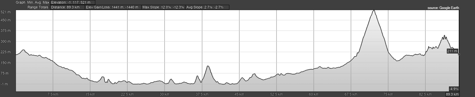
See the elevation profile of the route