Mount Pateras
Mount Pateras
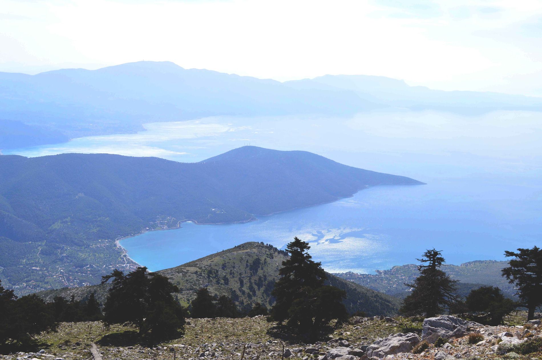
With a Total Area of 5763.03 hectares, a total perimeter (km) of 64.2, a maximum altitude (m) of 1132.0 (in the area of Megara-Leontari or Elatos peak) and a minimum altitude (m) of 300.0, the protected area (CORINE and wildlife sanctuary of life) is a part of Mount Pateras forms the mountainous edge of Attica in its northwest, as an extension of Parnitha, while it is connected through the valley of Vilia to Kithairona. Typical mountainous landscape of Attica with forests of Pinus halepensis (Halepian pine) and Mediterranean maquis. The highest peak is locally covered with Abies cephalonica forests. Its rare flora consists of dozens of remarkable plants, about 800 have been recorded, of which 67 are Greek endemics.
The eastern and southeastern side of Patera is designated as a wildlife refuge with a rich fauna of foxes, hares, hawks, eagles, partridges, nocturnal predators and various species of forest and semi-agricultural habitats. Almost all its slopes are steep and difficult to pass and are furrowed by large gullies like those of Agia Triada, Zoireza, etc. Its rock is particularly hard, with characteristic red soil. A large part of Patera was overgrown with pines and holly trees, while from 800 m and above there were fir trees, which were burned in the 1985 fire.
In ancient times, the mountain was called “AGHAION” (meaning anxiety in Ancient Greek), associated with the anxiety of the goddess Demeter when she was looking for Persephone. During the Middle Age, the Megarites cut trees from the mountain and made them pater for the roofs of their houses, so the mountain was named after the word “pater” which later became Pateras. Mount Pateras separates the Thriasian Plain from the Megarian plain. Closing with its volume from the Thriasian field to the Alcyonides and from Kineta to Oinoi, it created a major problem in the communication system between Attica and Megarida, characterized by the passage of Kakia Skala where since ancient times it was associated with the presence of the mythological bandit Skiron who robbed and killed passers-by by throwing them into the sea. The legend states that the passage was opened by the intervention of Theseus who killed Skiron. Even today, however, the passage of Kakia Skala is difficult due to landslides.
On the mountain there are also the Crypts, which are two small and two large karst sinkholes that cannot be seen by the human eye from the sea and the plain of Megara. The Megarians throughout their history found refuge in these basins and that is why they were called Crypts. Near the area where the Crypts are, we find Bathyhoria. Bathychoria are also hidden on the slopes of the mountain with cultivated fields and traces of ancient facilities. To the north of the great Bathyhori there is a circular tower which is one of the best-preserved monuments of antiquity. Its height is 12.5 m with a diameter of 6.2 m. At a distance of 500 m. to the N.W. the dirt road leads to the small Vathychori, there is a square tower with a height of 10 m and a diameter of 5.5 m.
Another characteristic is the surviving ruins of at least six towers, although there is some confusion about the historical origin of the towers in Bathychoria and the purpose of their existence. The circular tower was previously characterized as medieval, but today it is certain that it is a construction of the third quarter of the 4th BC. century. The tower belongs to a series of at least six towers, which mark the ancient road that ended in Boeotia. The Bathychoria towers were built in the second half of the 4th century. e.g. and are part of the defense system of Megaridos. They guarded this mountain road for the safe passage of troops from Peloponnese to Boeotia. This road was followed by the armies whenever they wanted to avoid the Athenians, who controlled the smoother road to the east and over the mountains.However, there is also the opinion that the towers in Bathyhoria existed simply to protect the estates of the area. This view is strengthened by the fact that the towers were not in a strategic place, did not have good visibility and their construction was not particularly strong. The Paths of Pateras Mountain, which were used since ancient times to connect the surrounding settlements, still offer opportunities for many interesting hiking routes. The ascent of Leontari peak from the settlement of Agios Georgios through the acropolis of Ereneia (traces of which are preserved) is interesting.